As I wanted to finish all open tasks for the free edition before X-Mas (so that I can start developing the pro version after the holidays 😉 ), I made another release which includes some great new features and lots of usability improvements (which you won´t probably notice at first glance but will hopefully lead to a better handling of the plugin especially in the backend). Thanks again @mkalina for your detailed feedback!
One personal request: as WordPress added a new review feature for plugins hosted on wordpress.org, I kindly invite you to leave your opinion about my plugin at http://wordpress.org/support/view/plugin-reviews/leaflet-maps-marker.
If you want to keep up to date with the latest Maps Marker development, please follow @MapsMarker on twitter or on Facebook
And now let´s get into the highlights of v3.3:
edit map-link for OpenStreetMap and Mapbox (OSM) maps
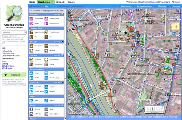
In case you don´t know: the default basemap OpenStreetMap (OSM) used by Leaflet Maps Marker is like Wikipedia for maps. Everyone can register on www.openstreetmap.org and help to improve the maps. In order to support this open approach, in v3.3 an edit link of the current map area gets added to the attribution text of maps using OpenStreetMap or Mapbox (OSM) basemaps.

Clicking on this edit link opens Potlatch 2, the map editor used on openstreetmap.org (you have to login with a free user account first):

By default, the edit link gets added on all maps using OpenStreetMap or Mapbox (OSM) as basemap. If you want to hide this edit link, please navigate to Settings / Map Defaults / Interaction Options, where you will find the new option “OpenStreetMap edit link” which you have to set to “hide”:

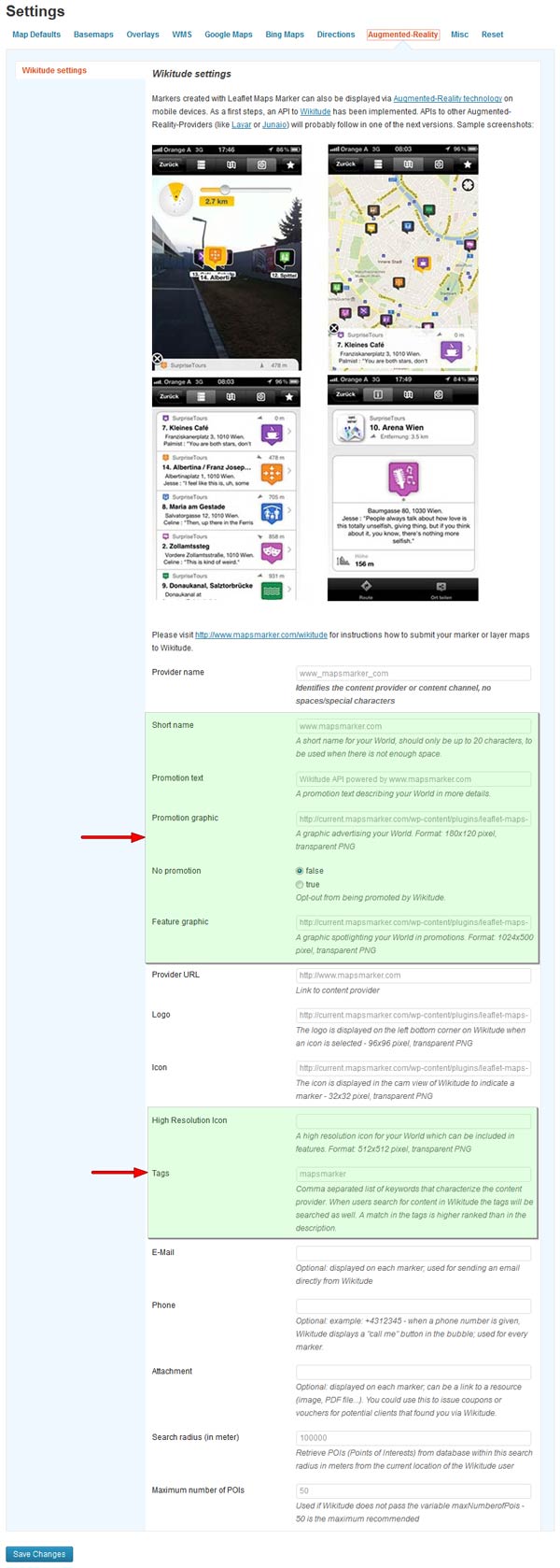
added new Wikitude fields enabling you to better promote your Augmented-Reality world & reset Wikitude world logo and icon to default values
The augmented-reality API of Leaflet Maps marker was also enhanced with v3.3, as Wikitudes added some new definitions to their ARML schema (especially for better promoting your augmented-reality World within Wikitude). Can will find those new fields in Settings / Augmented-Reality / Wikitude Settings – see screenshot below.
Please be aware, that with v3.3 I reset the Wikitude world logo and icon to the default value. This was necessary because I moved the default image files to a sub directory in a former version and therefore current users would not see any logo or icon when registering their world. In case you changed those values, please update them again!

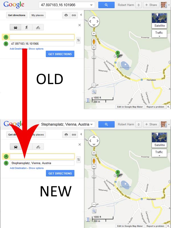
address is now used for Google directions links instead of latitude/longitude
Leaflet Maps Markers default direction provider is set to Google (but can be changed to yournavigation.org, map.project-osrm.org or openrouteservice.org in Settings / Directions / General directions settings). With v3.3 and using Google as direction provider, now not longitude and latitude are sent to Google but the address (if set, otherwise lat/lon is used – thanks Pepperbase!):

show info under list of markers below layer maps if more markers are available
Layer maps allow displaying a list of markers under the map. By default, a maximum of 100 markers is shown in this table (this can be changed in Settings / Map Defaults / List of markers settings).
In case have more markers on your map, you now see an info box below the last entry:

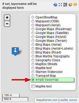
option to use an empty basemap
For some special usecases (in case you just want to work with overlays only) you might want to use an empty basemap for their maps. This is now also possible with v3.3. The “empty basemap” is disabled by default, but can be enabled in Settings / Map Defaults / Available basemaps in control box.

Translations updates
Thanks to many motivated contributors, v3.3 comes with the following translation updates:
Updated translations
If you want to contribute to translations (Persian would be great 😉 ), please visit http://translate.mapsmarker.com/projects/lmm for more information.
Other changes/optimizations
Bugfixes
Outlook – my plans for the next release
As now pretty all features I wanted to include in the free edition are finished, I will start focusing on the pro version. On the roadmap are features like marker clustering, display of routes/GPX-files, adding markers from frontend and lots more. If I can stick to the plan, I plan to release v1.0 around March. Please be patient – I am sure you will like it 😉
Full changelog (show previous changelogs)
| edit map-link for OpenStreetMap and Mapbox (OSM) maps (can be disabled) | |
| address (if set) is now used for Google directions links instead of latitude/longitude (thanks Pepperbase!) | |
| show info under list of markers below layer maps if more markers are available | |
| added new Wikitude fields enabling you to better promote your Augmented-Reality world | |
| dynamic preview of control box status (hidden/collapsed/expanded) in backend | |
| option to use an empty basemap (in case you just want to work with overlays only) | |
| added menu icons on backend and translations image on changelog | |
| added warning message if plugin “WordPress Ultra Simple Paypal Shopping Cart” which breaks settings page is active | |
| autofocus marker/layer name input field on backend (HTML5) | |
| improved tab order of input fields on marker and layer edit pages on backend | |
| reset Wikitude world logo and icon to default values (please update if you changed them!) | |
| warning message with WordPress 3.5 on layer edit pages on backend ($wpdb->prepare issue) | |
| updated Portuguese (pt_PT) translation thanks to Joao Campos, http://www.all-about-portugal.com | |
| updated Dutch translation thanks to Patrick Ruers, http://www.stationskwartiersittard.nl | |
| updated German translation |
Please let me what you think of this new release. If you have any issues, please see this page on how to get support. If an important feature is missing, please add your feature requests on Github. I am also looking for more translations – if you would like to contribute a new one, please visit this page for more information. And of course I´d very appreciate your review for my plugin on wordpress.org 😉